
Before we left North America and arrived in Malaysia, we wanted to get a sense of where Kuala Lumpur was in Malaysia and where it was in relation to Singapore and Thailand. And so we looked for maps to help us visualize KL’s location.
And so, we created and collected the maps below to do just that for you to help you with your research on relocating to or visiting Malaysia and Kuala Lumpur. Some of the maps are embedded and are dynamic and others can be expanded if clicked on.
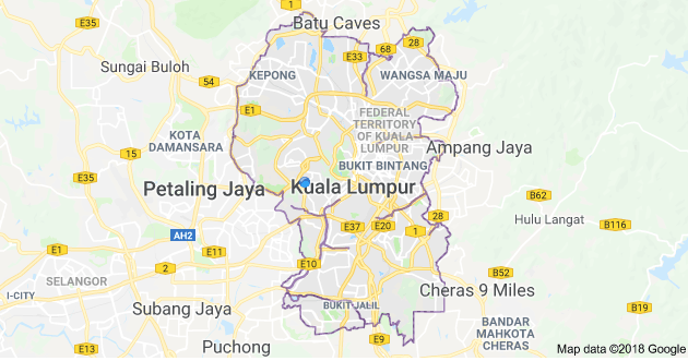
The city of Kuala Lumpur in Western Malaysia is not far from the coast. Shown here in Google Maps.
Malaysia and its capital Kuala Lumpur on Google Maps.
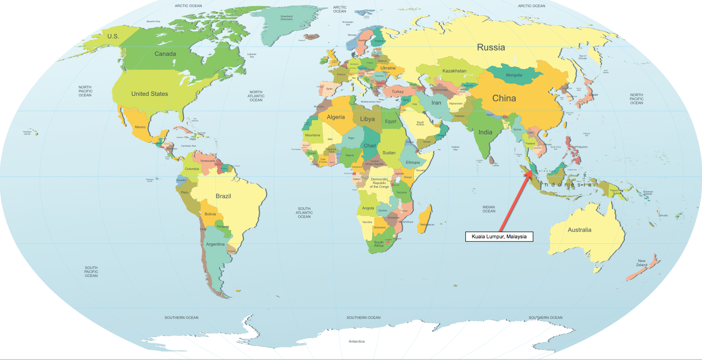
This map shows the location Kuala Lumpur on planet earth. The city is in the west central part of the western Malaysia peninsular . It is centrally located in Southeast Asia, only a few hours flight from cities like Bangkok, Thailand and Singapore, and countries such as Vietnam, Cambodia, Indonesia and even Australia (5 hours by air).
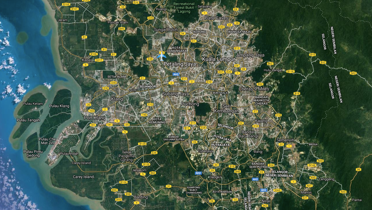
This satellite map of greater Kuala Lumpur shows how extensive the city and its suburbs are all the way west to the Port of Klang (Kelang).

This Kuala Lumpur map shows some of the city’s landmarks including the famed Petronas Towers, the KL Tower, the Islamic Arts Museum and KL Bird Park.
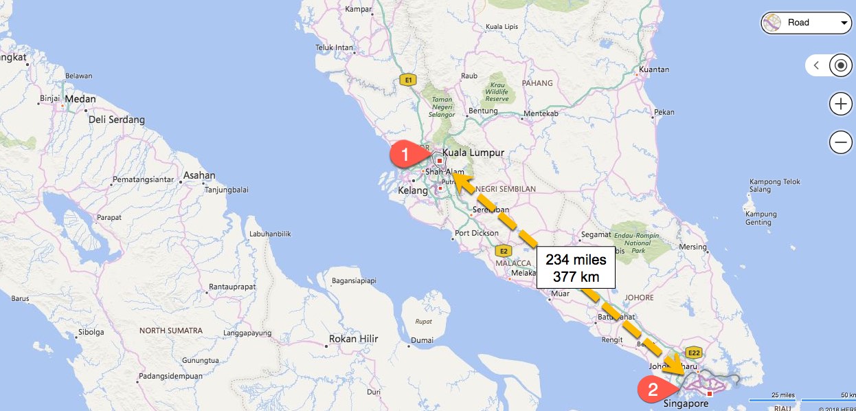
The distance from Kuala Lumpur to Singapore is shown on this map. It is 234 miles or 377 km to fly and takes about 45 minutes. It takes about 4 hours to drive between the two cities.